
A historic blizzard is raging on Saturday from the northern Mid-Atlantic to New England, with Boston recording its snowiest January day and one of its top 10 storms of all time with at least 23.7 inches.
The latest: Reports of 16″ of snow have come in from parts of southeastern Massachusetts and eastern Connecticut, according to the National Weather Service’s (NWS) Boston office.
- More than a foot of snow fell in coastal New Jersey, with 7.5 to 10 inches in the metro New York City area. Islip Airport on Long Island reported 22.4 inches.
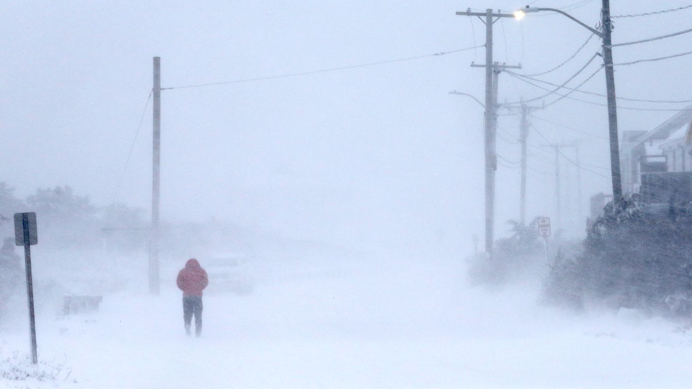
- As of Saturday evening, A foot-and-a-half to two feet had fallen in the Boston area from Plymouth to Essex counties, with the powdery snow blowing and drifting in the frigid winds. Final totals could reach 30 inches in some locations, as light snow was still falling.
- Given the high winds, lack of visibility and phenomenal snowfall rates, airports are having a hard time staying open.
- There have been about 3,500 flight cancelations today in the Northeast according to Flight Aware, including 89% of flights going to or from Boston.
- Amtrak canceled Acela service between Washington, D.C. and Boston on Saturday due to the storm, and there will be no Northeast Regional Service between Boston and New York. Regional New England routes have also been canceled.
- In a Friday evening press conference, Massachusetts Governor Charlie Baker asked residents to stay home throughout Saturday. “Two to four inches per hour is basically whiteout conditions,” he said, referring to peak snowfall rates.
- Travel in southern New England is “very dangerous to nearly impossible,” the NWS said Saturday morning.
The big picture: The storm is being energized by powerful jet stream winds and a contrast in air masses as Arctic air pours in from Canada. The low-pressure area responsible for this blizzard is intensifying at an “explosive” rate, the NWS said.
- The storm itself has undergone a meteorological process known as bombogenesis, which is why it is referred to as a bomb cyclone.
- Bombogenesis occurs when the minimum central air pressure in a non-tropical storm drops by at least 24 millibars in 24 hours. In the case of this blizzard, the pressure drop was 35 millibars in just 18 hours, which greatly exceeds the definition.
- In general, the lower the pressure, the stronger the storm.
- As the low intensified throughout the day, it pushed intense bands of snow featuring whiteout conditions north-northwestward, into Connecticut, Rhode Island and Massachusetts. Heavy snow has also been affecting coastal Maine.
- A combination of the frigid temperatures in the low teens, record warm ocean temperatures for this time of year and strong atmospheric lift may yield thundersnow in the heaviest snow bands, a phenomenon associated with the most intense winter storms
- Warmer than average ocean temperatures off the New England coast will aid in intensifying the storm and adding more moisture to it, helping it produce extremely heavy snowfall over land.
Threat level: The jackpot region looks to be in eastern Massachusetts, where NWS forecasters are warning that “Localized amounts up to 3 feet are possible.” A snowfall total of 28 inches or higher would set the all-time record in Boston, a city that is no stranger to these types of winter storms. A two-foot total would put it in the city’s top 5 list.
- Winds gusting between 65 and 75 mph in eastern Massachusetts, particularly Cape Cod and the Islands, are causing power outages, with about 102,484 customers out of power in the Bay State as of 5:30 p.m. ET, according to the Massachusetts Emergency Management Authority.
What’s next: Heavy snow and high winds are forecast to rage in portions of southern New England through the evening, ending by midnight as the storm pulls away, off into the North Atlantic. But a bitterly cold night with wind chills below zero will make cleanup difficult, and pose a risk to anyone venturing out.
Flashback: Many of the Mid-Atlantic and Northeast’s biggest snowstorms on record have occurred since 2000, in line with climate change-related trends toward more frequent and severe heavy precipitation events.
- Before Saturday, five of Boston‘s top 10 snowstorms had occurred since 2003, and eight of its top 10 since 1978.
- In New York City, seven of its top nine biggest snowstorms have occurred since 1996, with six of them since 2003. Three of its top five have occurred since 2006.