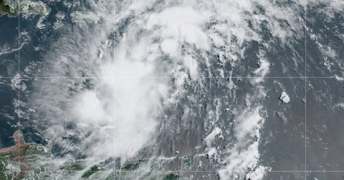
The latest tropical weather system churning in the Caribbean Sea is expected to get upgraded to Tropical Storm Isaias by Wednesday night, with Puerto Rico and several other Caribbean islands under storm warnings.
As of the 11 a.m. advisory from the National Hurricane Center, Potential Tropical Cyclone Nine was located 240 miles southeast of San Juan, Puerto Rico, had winds of 45 mph and was moving west-northwest at 23 mph.
The Leeward Islands were experiencing tropical storm conditions Wednesday morning, with the Virgin Islands and Puerto Rico expected to feel the storm later in the day. Even though it had reached tropical storm strength winds, it had not gotten upgraded to a named storm because it had no closed center of circulation.
Tropical Storm warnings are in effect for Puerto Rico, the Virgin Islands, most of the Leeward Islands, parts of the Dominican Republic, parts of Haiti, the Turks and Caicos and the southeast Bahamas. A Tropical Storm watch is in effect other parts of the Dominican Republic, Haiti, the central Bahamas.
The system will move through the Leeward Islands Wednesday, near or over the Virgin Islands and Puerto Rico Wednesday night, near or over Hispaniola Thursday, and near or over the southeastern Bahamas on Friday.
Let our news meet your inbox. The news and stories that matters, delivered weekday mornings.
Without a closed center of circulation, the forecast track and intensity of the system beyond Puerto Rico were hard to forecast. It remains unclear how the storm could impact Florida, the Gulf Coast and the southeast coast this upcoming weekend.
This system will have a lot of obstacles in front of it over the next few days that could impact its track and intensity.
The first major hurdle will be Hispaniola. The top five tallest mountain peaks in the Caribbean are located in Hispaniola, with the tallest being Pico Duarte standing tall at 10,164 feet. Mountains this tall can shred tropical cyclones apart, especially weaker storms. If the center of circulation runs directly over Hispaniola that will result in a weaker storm. If the center can stay over open water, it could remain stronger.
Here’s what meteorologists know and don’t know about Potential Tropical Cyclone Nine:
What we know
- This disturbance likely becomes Tropical Storm Isaias by Wednesday night
- 3-6 inches of rain, up to 10 inches, is forecast for Puerto Rico which could lead to flash flooding and risk for mudslides
- Tropical storm force winds are likely throughout Wednesday across Leeward Islands, Virgin Islands and Puerto Rico
What we don’t know
- The track and intensity beyond Puerto Rico and Hispaniola
- Timing of wind and rain impacts for Bahamas and Florida by the end of week
- Forecast for Florida or the Gulf Coast this weekend remains highly uncertain
When named, it will be the earliest “I” named storm on record. The average date for an “I” storm is October 4th.
A reminder: a Potential Tropical Cyclone is a disturbance that is not yet a tropical cyclone but has a high chance of formation. The designation allows the National Hurricane Center to issue advisories for areas in harm’s way if tropical storm conditions are imminent thereby giving more lead time for preparation.
Kathryn Prociv
Kathryn Prociv is a meteorologist and producer for NBC News.
