


Both storms are forecast to strengthen into hurricanes over the Gulf of Mexico in the coming days.
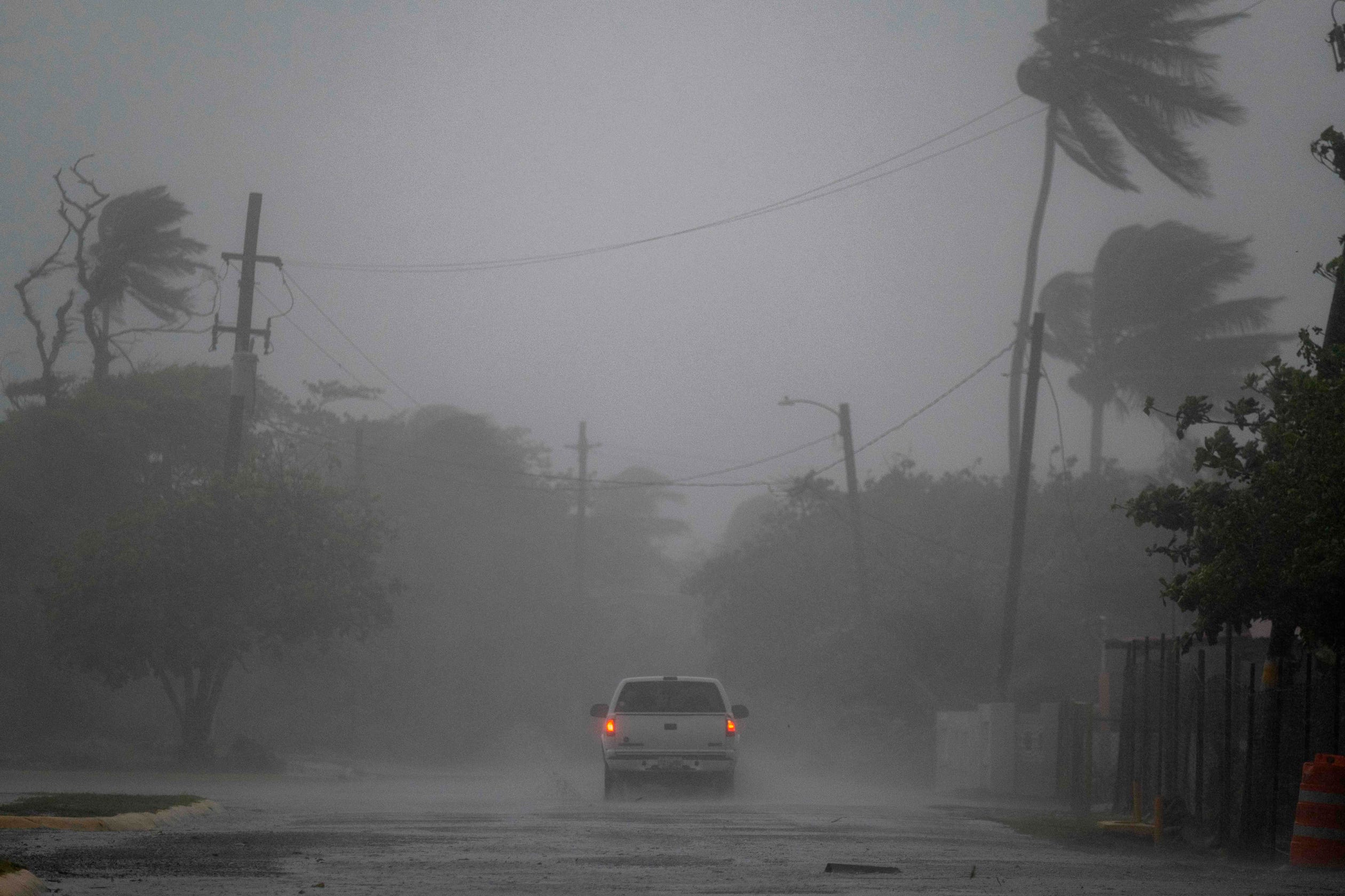
MONROE, La. – Tropical Storm Marco moved closer to Louisiana on Monday, one of two strong systems threatening a historic one-two punch along the Gulf Coast.
After spending much of the day Sunday as a hurricane, Marco was likely to make landfall Monday afternoon or evening in Louisiana as a tropical storm, forecasters said. And, then, Tropical Storm Laura is expected to reach hurricane status before it roars into the state Wednesday.
National Weather Service meteorologist Benjamin Schott said such a confluence of storms hasn’t happened in the Gulf of Mexico in recorded history. Isolated areas could see 15 inches of rain from the two storms, he said.
The National Hurricane Center cautioned that despite weakening from a hurricane on Sunday, Marco could still cause “life-threatening storm surges and dangerous winds” along the Gulf Coast.
“We have a very unique situation with two storms that unfortunately are headed to Louisiana,” Gov. John Bel Edwards said Sunday. “They pose a challenge we have quite frankly not seen before.”
Edwards said the double hit of storms will blanket the state’s coastline with storm surge as high as 10 feet in some areas and prompt flash flooding in others. He said residents should be ready to shelter in place for at least 72 hours, warning that it may not be possible to deploy rescue helicopters and high-water vehicles after Marco’s storm surge if Laura comes in right behind.
Because of the COVID-19 threat, Edwards said, the state plans to activate large shelters with congregate settings only “as a last resort.” Instead, the governor said, he’s working with the federal government to use hotels and motels if large evacuations become necessary.
Officials in LaPlace, 30 miles upriver from New Orleans, distributed sandbags in low-lying areas and urged residents to seek cover and prepare.
On Grand Isle, south of New Orleans, Starfish Restaurant manager Nicole Fantiny watched a long line of people driving off the barrier island.
“They are all packing up and leaving,” she said. “My house was built in 1938, so I think we’re good.”
Louisiana State University canceled all classes, activities and COVID-19 testing centers on campus Monday due to Marco, the university announced Sunday.
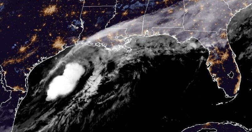
As of 8 a.m. EDT, the center of Marco was about 85 miles south-southeast of the Mississippi River, powering maximum sustained winds of 50 mph as it slid to the north-northwest at 10 mph. Marco will hit parts of Louisiana, Mississippi and Alabama with storm surge, heavy rainfall and strong winds. The system was downgraded to a tropical storm Sunday night.
The storm is expected to hook westward and likely reach Texas as a tropical depression Tuesday.
Meanwhile, Laura strengthened near eastern Cuba on Sunday night after killing at least 11 people in the Dominican Republic and Haiti. The storm was traveling west-northwest at 21 mph, with maximum sustained winds of 65 mph, according to the National Hurricane Center’s 8 a.m. EDT advisory.
Puerto Rico Gov. Wanda Vázquez declared a state of emergency, and Federal Emergency Management Agency Administrator Pete Gaynor said his teams were “on the ground and ready to support.” Downpours and gusty winds drenched the island, and nearly six inches of rain fell in some areas, prompting flood warnings.
On the U.S. mainland, a tropical storm warning was issued for portions of the Florida Keys as Laura approached. The Keys could see winds between 39 to 57 mph through early Tuesday.
Laura was forecast to sweep over the southeastern Gulf of Mexico late Monday into Tuesday.
“Environmental conditions will be more favorable for strengthening, and Laura is expected to become a hurricane prior to reaching the Gulf Coast,” AccuWeather senior Meteorologist Rob Miller warned. Landfall could come Wednesday.
Schott, the Weather Service meteorologist, said Laura could make landfall as a Category 3 hurricane. If that happened it would be the first Category 3 hurricane to strike Louisiana since Hurricane Rita in 2005.
Mississippi Gov. Tate Reeves declared a state of emergency.
“We are in unprecedented times,” Reeves said. “We are dealing with not only two potential storms in the next few hours, we are also dealing with COVID-19.”
The storms could keep coming as tropical waves emerge off the coast of Africa, according to AccuWeather meteorologist Bernie Rayno. The heart of the 2020 hurricane season, which is just getting underway, is expected to be extremely active, he said.
The Atlantic hurricane season already has been a record-breaker. Laura is the earliest L-named storm in the Atlantic Basin, breaking a record held by Luis, which formed Aug. 29, 1995. This season has had 13 named storms, well above-normal activity.


