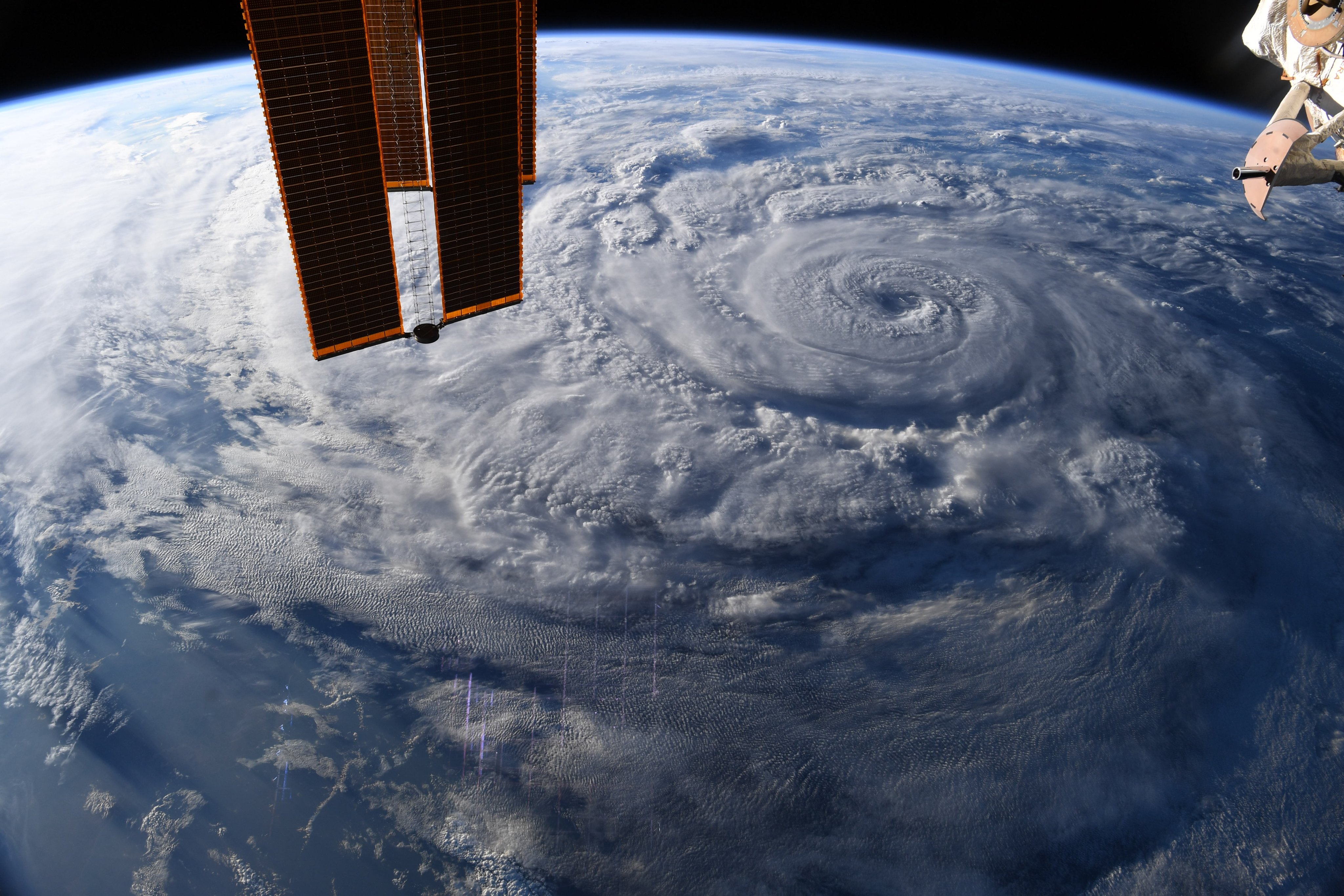
Genevieve has now weakened to a tropical storm, according to the National Hurricane Center (NHC), but still has the potential for substantial damage.
“Continued heavy rainfall from Genevieve may lead to life-threatening flash flooding and mudslides across portions of far southern Baja California Sur through today,” the NHC warned in an update Thursday morning. “Large [ocean] swells generated by Genevieve will affect portions of the west-central coast of Mexico and the coast of the southern Baja California peninsula through Friday.”
The storm’s power is also highly visible from space. On Twitter, NASA astronaut Chris Cassidy sent three pictures Wednesday (Aug. 19) from the International Space Station showing the eye and the overall size of Genevieve, beneath the robotic Canadarm2, the station’s solar panels and a Soyuz spacecraft. Cassidy’s only comment on the storm, which stretches over most of the visible Earth in each photo, was including the hashtag #HurricaneGenevieve.
Two satellites also ferried images of the hurricane to Earth. The GOES-16 satellite — also known as GOES-East in reference to its geostationary position above Earth — obtained a dramatic video on Wednesday, while sustained wind speeds reached a maximum of 115 mph (185 km/h).
For our #ImageOfTheDay, @NOAA’s #GOESEast used its hi-res visible band to view #HurricaneGenevieve’s eye. As of Wednesday p.m., #Genevieve had a maximum sustained wind speed of 115 miles per hour. More: https://t.co/vCPKN24LBq pic.twitter.com/hUCYSGv0i0August 19, 2020
The imagery posted to Twitter shows high-definition visible imagery from the eye of Genevieve, with swirling clouds at the center rippling waves further out from the eye. GOES-16 is a co-operative program managed by the National Oceanic and Atmospheric Administration (NOAA) and NASA.
NOAA’s Suomi NPP satellite also watched the hurricane in infrared wavelengths to give more information about the storm’s strength, structure and size, NASA said in a statement. The agency shared a nighttime image of Genevieve based on data from Suomi’s Visible Infrared Imaging Radiometer Suite (VIIRS) instrument.
“The hurricane’s eye was still visible and well defined,” NASA said of the image, which was created using data from the NASA Worldview application. “[The eye] was surrounded by powerful thunderstorms, although deep convection is generally lacking over the southwestern portion of the circulation.”
Hurricane and tropical storm warnings remain in place in the Baja region, according to data from the National Hurricane Center.


